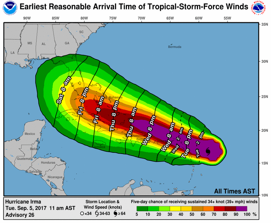
Irma’s Track Could Bring Rain, Strong Winds to NE GA and the Upstate Next Week
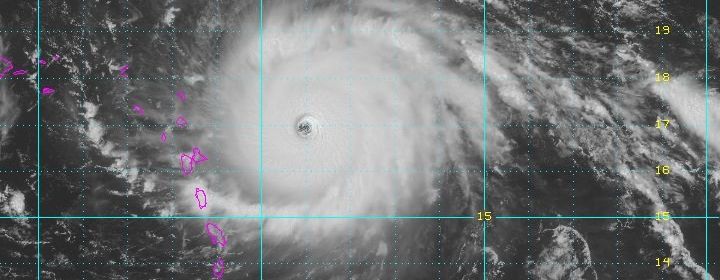
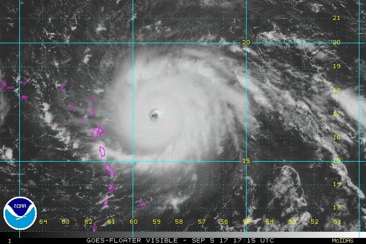
Photo courtesy NOAA’s National Hurricane Center
Forecasters are tracking the path of Hurricane Irma, which is now a powerful category 5 storm headed to the Caribbean.
The storm is expected to cross over Cuba sometime Saturday and hit the southern tip of Florida by Sunday.
Meteorologists with the National Weather Service in Greenville-Spartanburg are watching the storm closely and now say there’s a good chance we will feel some effects of Irma in Northeast Georgia and the Upstate early next week.
That’s according to Meteorologist Lauren Carroll.
She says right now the computer models are converging on a more definite track for Irma, which she says could bring it across our area.
“It seems to be that things are starting to converge on a solution that’s bringing the track relatively close to our area,” Carroll said. “We are inland and there are a lot of things that would affect the impact. For example, there are mountains in Cuba so if it goes over those mountains, it will get torn up a lot more and it would be weaker if it was able to get up here versus if it goes through the Florida straights and doesn’t really interact with land, that might mean a stronger storm if it gets up here. So there are a lot of little things that seem like small issues but could affect the eventual impact.”
CourtesyNOAA’s National Hurricane Center
However, Carroll says if Irma does track across Georgia and the Upstate it will have weakened considerably and it will most likely come through as tropical depression or strong thunder storm.
“Right now, based on what we’re seeing, it’s late Monday and into earlyTuesday morning when it gets up here,” she explained. “We’re starting to advertise that we do think that there could be some strong, gusty winds up here and heavy rainfall is pretty much always a threat with any kind of tropical system, whether it’s a tropical storm or a hurricane, strong or weak, heavy rainfall is always an issue.”
Carroll said people should take the usual precautions when preparing for heavy rain or strong storms and have a plan in place anytime there’s inclement weather in the forecast.
People up here, she says, though should avoid panicking because Irma is not likely to cause any real problems for our area.
What we can tell you right now is there is still a lot of uncertainty. So we’re asking people to not get hung up on any one track. A lot of people are sharing computer model data and things like that and we’re saying don’t get hung up on any one. We’re still about a week out up here and things are probably going to change just a little bit,” Carroll advised.
And of course, WNEG News will continue to monitor the path of Irma and will bring you the latest information on how it might affect our area in the coming days.